Roadtrip: Theodore Roosevelt National Park day 1
Our roadtrip vacation has just gotten started. After leaving home Monday night, we arrived at Theodore Roosevelt National Park Wednesday evening, maybe 6:00 or 7:00 PM. Or maybe it was 8:00 PM. The thing is, we never really knew what time it was, since the border between the Central and Mountain time zones zigzags through this area and our two phones could not agree on what hour it was.
We didn't really care though, as the vacation had essentially just started and we were eager to see what TRNP had to show us.
After a late night of stargazing, counting satellites (saw the ISS blazing right overhead too), and seeing a couple of meteors (stragglers from the Perseids meteor shower which had peaked a night or two earlier?), we decided to do some hiking the next morning.
A stop at the nearby visitor center/ranger station taught us that there is an easy 1-mile loop trail we could start with. Actually, here's a map:
We stayed at the Juniper campground. The road is in red, with hiking trails as green dotted lines. The "Little Mo" trail was the easy loop, and it gave us a great view of the rain-swollen Little Missouri River (which is actually the time zone border here):
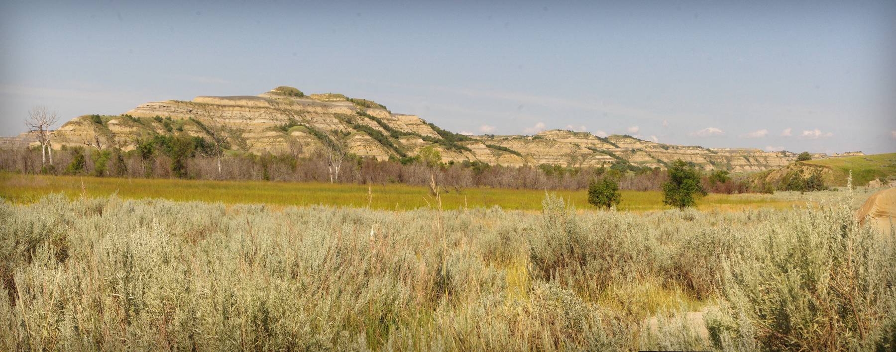
Note: there will be lots of panoramic shots in these posts, as it's the only way to get a sense of how impressive some of these views are. Please click them to enlarge! Note that you may want to r-click and open the image in a new browser tab or window so you can view it full size. You'll know a panorama shot as it's wider than all of the other photos in my posts.
The guide at the visitor center said that the "trail" that went south and crossed the river was a trail in name only -- we'd need a geo map and compass for that one. Plus the river had to be forded -- the water is "probably only waist deep" though.
After quickly deciding that waist-deep river fording was not really the way we wanted to start what was the first fun day of our vacation, we headed out for the Little Mo trail. Nothing wrong with taking paved trails sometimes, right?
 |
| The camera went a little goofy color-wise with some of the shots that went into this panorama |
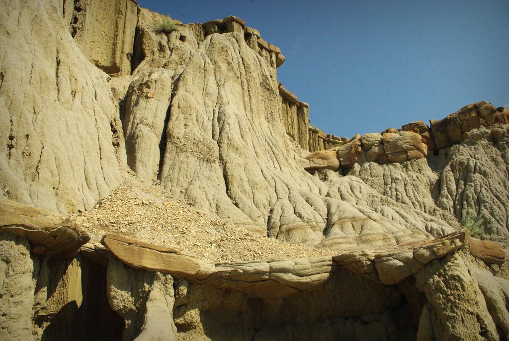
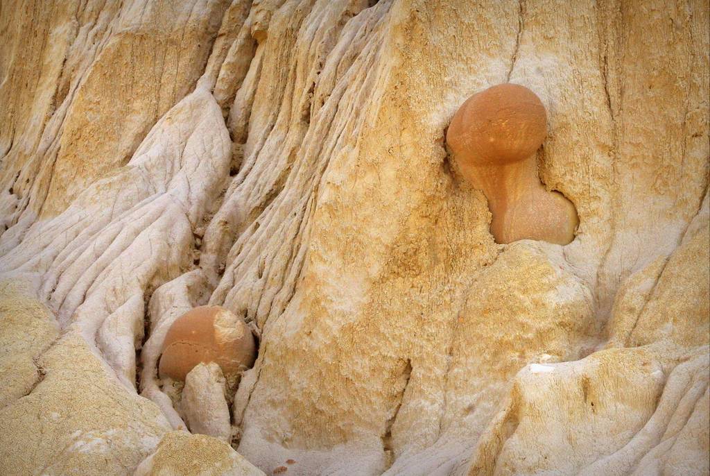
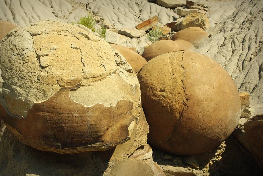
After this little trail as a warmup, we decided to hike part of the Buckhorn trail (see map above) which starts at the Cannonball Concretions and goes north and slightly west. So what are "Cannonball Concretions"? Well, they were our first up-close view of rocks:
These concretions are roundish boulders (some remarkably so), exposed after the softer rocks surrounding them were eroded away.
There's more to it than that, but to be honest I didn't read the sign that explained in more detail how these formed as I was too interested in actually looking at them, and also eager to hit the trail.
At this point I should mention two facts. First, there were very few people in the park, and we didn't see anybody else hiking this morning. A few cars drove by once in a while, but it was wonderfully quiet for the most part, just us and the rocks.
Second, the guide at the visitor center warned us that there was a bull bison (buffalo) somewhere in the area that we'd be hiking. Although not predators the bulls can be aggressive and some park visitors had been charged this summer. He warned us to be aware, and if we see the bison to give them plenty of space. He also said that there are some little rattlesnakes out here, but we most likely wouldn't see any -- he just needed to make us aware.
So I finished taking photos of the concretions, we signed the hiker's logbook at the start of the trail, and headed out.
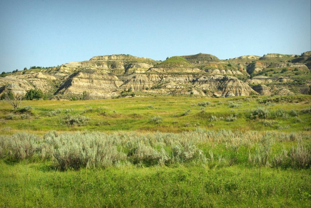
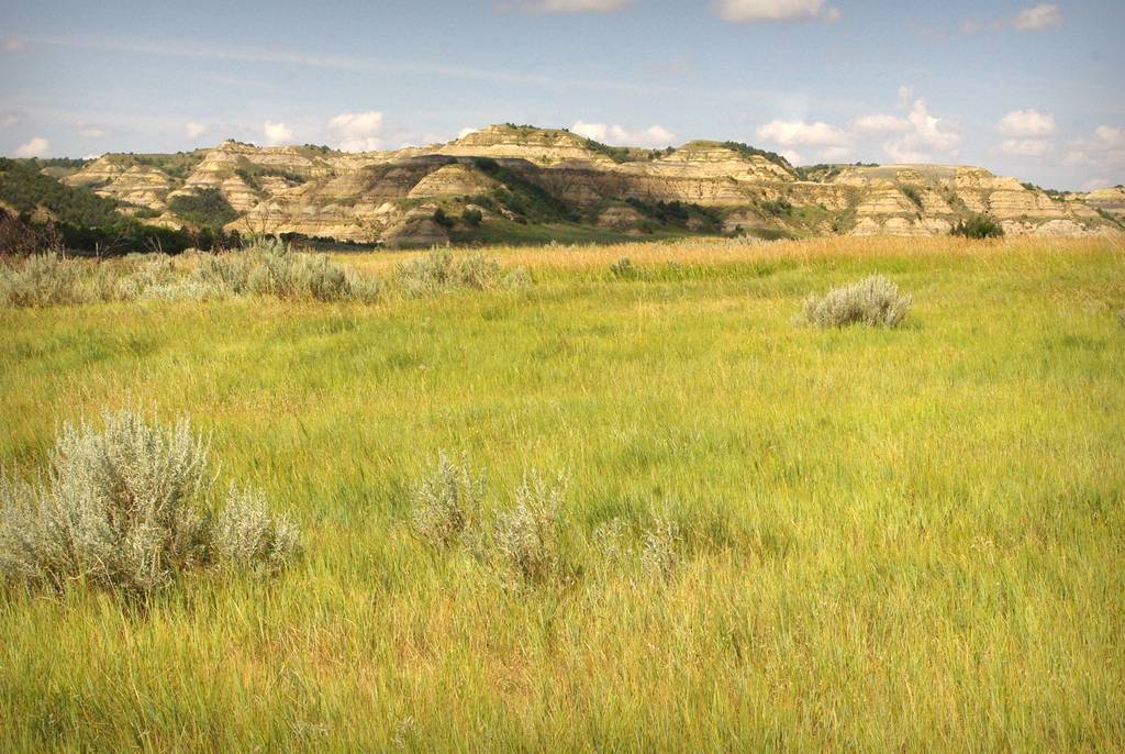
Although it looked like a mix of sagebrush and grassland in front of us...
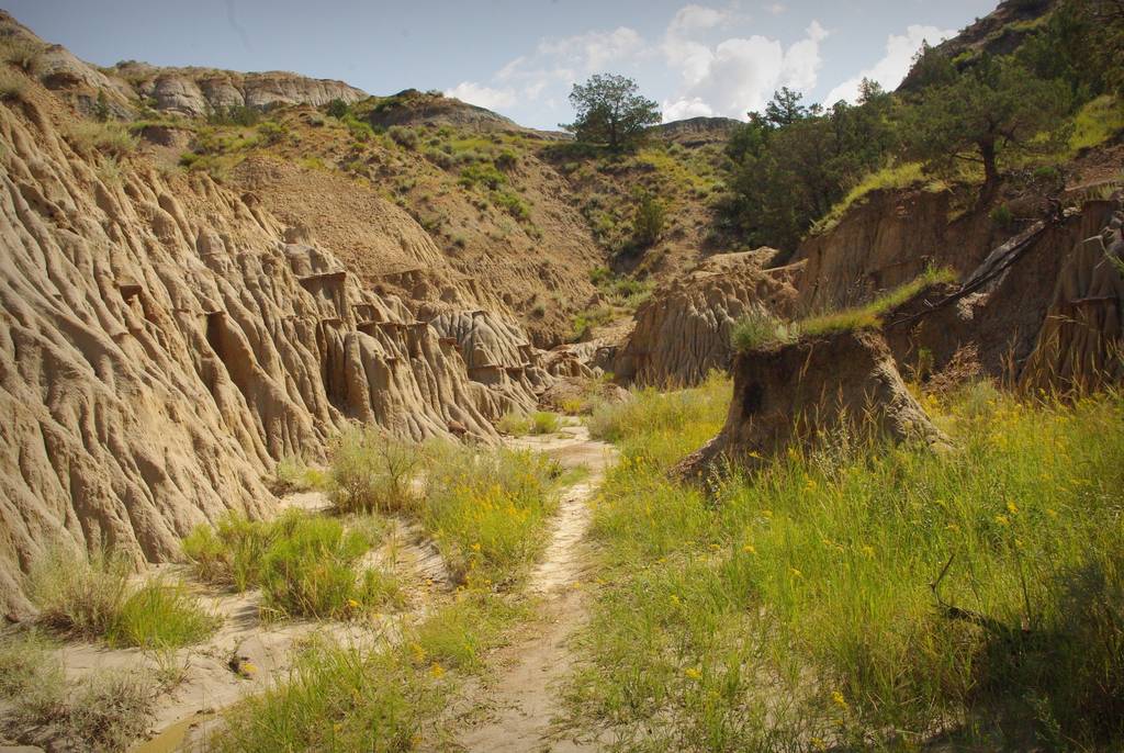
...there were some side trails that we had to check out once in a while, which always dead-ended after a short while:
In one of these is where I saw my first wild cactus! (I'm not sure if it was the first I've *ever* seen in the wild, but it's definitely the first I've seen in many, many years if not the first ever):
This was the only one I saw in the whole park, and unlike areas that we'll be visiting later in the trip there's no danger of stepping upon these Opuntia because...
...they were growing on top of these... well, what do you call them? Hillock? Small mesa? Whatever they're called, the cactus were at about eye level, which is actually a bit more dangerous than underfoot now that I think about it.
So out of the little canyon and back onto the Buckhorn trail...
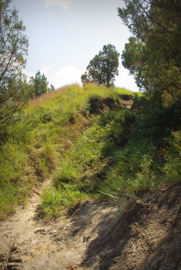
After a while the mostly flat, grassy ground was broken by small ravines that made the hiking much more strenuous:
Although not very deep (maybe 15' (4.5m) at most where the trail crossed them) the repeated uphill climbs were tiring us out. So after an hour and a half or so, we took one last look...
 |
| Yes, this is another panorama -- click for larger! |
...then decided to turn back. So we turned around, and saw this:
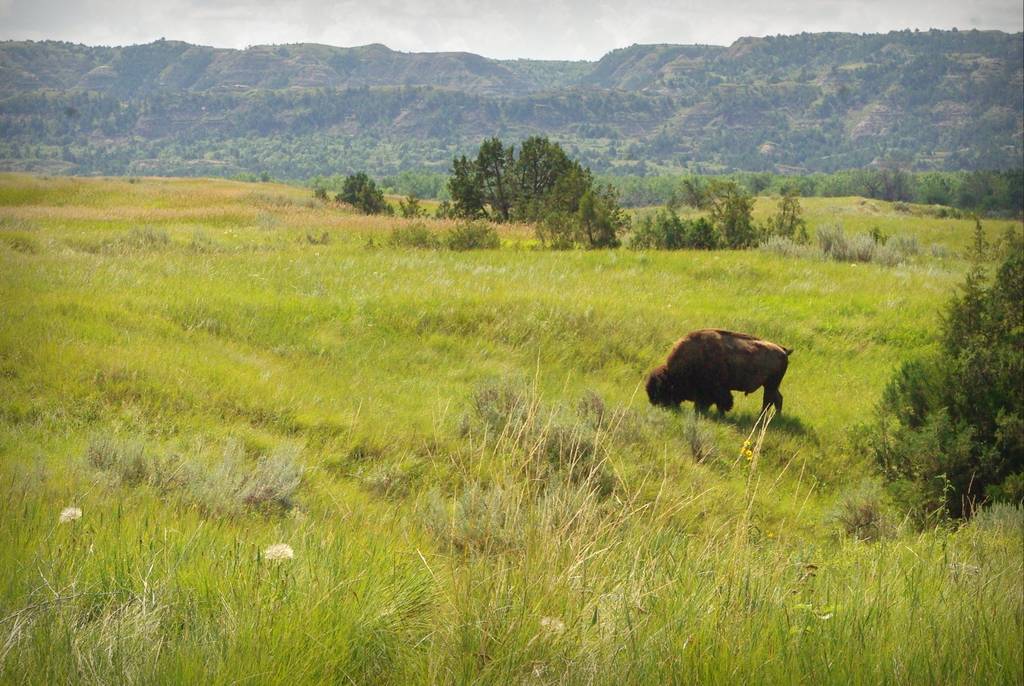
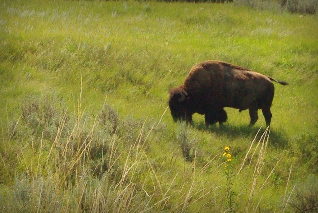
The bull buffalo that we were warned about was standing essentially on the trail! We had gone down into that ravine just a minute ago, and now there he was, probably 75' (23m) away, blocking our path. (I took this shot with a 55mm lens to give you an idea of perspective and distance. It's only slightly cropped.) The ravine is really hard to see but it cuts right across the bottom half of the photo -- it's more visible where the trees are on the right edge of the photo.
He turned away from us as if to take the trail back the way we wanted to go, and we had a quick discussion about what to do next. Our options were to 1) continue forward on the trail, eventually reaching the road -- another hour or more of hiking -- or 2) follow the bison, keeping our distance and hoping he'd move far enough off the trail that we could safely pass.
He kept turning his head to look at us which made us nervous, so we decided to go with option #1 and move forward.
If you take a look at the map above (or just below), you'll see where the Buckhorn trail (green dotted line) crosses a stream or creek. We did that, then suddenly had 4 or 5 trail choices to make, none of them clearly the "real" trail. We chose badly, as we then crossed the stream again -- something that the map does not indicate.
For fear of taking the wrong trail too far, we decided to head back and see if the bison had moved off. My main fear was that he'd be in one of the ravines and we'd suddenly be upon him, but luckily we saw him on a hill -- he was rolling around in the dust!
So I decided that we could take a little detour off the trail to give this guy plenty of room, loop around and meet the trail again and continue back to the start of the trail at the concretions. So keeping an eye on the buffalo's dust cloud, we circled around, came up over a little hill -- and saw another buffalo standing there, eyeing us!
Maybe it was the original animal, but I then realized that there were at least six of these beasts in this area with most of them where the wallowing one was, but this one loner was the close one, the guy to watch.
At this point we decided that abandoning the trail and cutting straight across the land was our best bet, as the road to the west was visible from our higher vantage point. Here's the map again so you don't have to keep scrolling up:
We were essentially where the "X" in "Long X Trail Pullout" was, so getting to the road meant going down an easy-looking hill, crossing the stream again, crossing a large grassy area, then climbing a rise back to the road. Easy, right?
Have you ever tried to pick a trail through even mildly rugged terrain? It's not as easy as it looks, as we found marshy ground, rocks, lots of sharp grass, etc. Plus when we got across the stream and looked back we saw that all of the buffalo were now following us, moving down the hill. Not running, but definitely following us. Maybe they just happened to be moving in our direction, but we took that as incentive to make it to the road more quickly.
I have to give my wife credit, as she only said "we are going to die out here" one time (she wasn't joking when she said it) and was clearly starting to overheat -- it was after 12:00 (or 1:00) and getting to be quite warm -- but she kept pace with me, and I'm not a slow walker even when not being "chased" by 700 lb. animals.
We finally made it to the road, she sat down in the shade of a little tree and tried not to pass out, and I weighed the prospect of us walking the hot road back to camp... when a car came along not 3 minutes later!
I quickly flagged it down, told the story of the buffalo chase to the young couple driving -- the herd was still crossing the grassy lowlands toward us, adding credibility to our story -- and they gladly drove us back to the concretions. Saved!
So our first morning in a National Park on this trip was a memorable one for sure.
At least we didn't see any rattlesnakes.
.








Amazing! It's been 20 years since I was there (I didn't take pictures nearly as nice as yours) but cannonball rocks and buffalo are the two things I still remember vividly. And the lack of people. Not much seems to have changed... (My wife just said that she'd love to go back, and so would I.)
GREAT photos. My husband is from north central ND and we've been down in that area several times...Medora, White Butte, etc. And we have seen rattlers. Pretty yellow ones.
The night sky is awesome there. And the sunsets during harvest...oh my.
Glad you didn't get stomped!! Look forward to the next chapter...
I'm so glad you two are all right! Big thanks to the nice couple.
Your story is fascinating. I hear myself saying. "No!" like I'm watching television. Have you considered writing novels. Give it some thought.
I'm not sure what happened to the panorama shots -- they're too small! Let me replace them with the correct (larger) sizes, as small defeats the point of panos.
Okay, fixed it. The panoramic shots should be full-sized now. Photobucket changed something... I wonder if the large images in my older posts are all broken now? Yep. Oooh, somebody is getting a nasty email...
Seriously? What a way to start your vacation.
Wow that was a very interesting post, in addition to the lovely photos. You write well, as I can almost hear the snort of the bison while seeing the dust clouds.